In Search of Polycentric St. Petersburg
Method
We asked workshop participants to make a map of their district limited by a 500-metre radius, with their house in the centre. Key services were to be drawn on the map, as well as key streets and traffic flows.
A city on a human scale is a city consisting of districts that work at a human speed, and that are connected to each other with arterial roads, and via information networks with the rest of the world.
From Urban Planning to Urban Habitat
The idea of such a simple but effective and thrilling exercise came from a thesis that Russian cities are developing in a ‘centralized’ model, where the key services and businesses are concentrated in the downtown area, while the fast-growing outskirts are mostly residential, which leads to a gap in the quality of life in the centre and the outskirts.
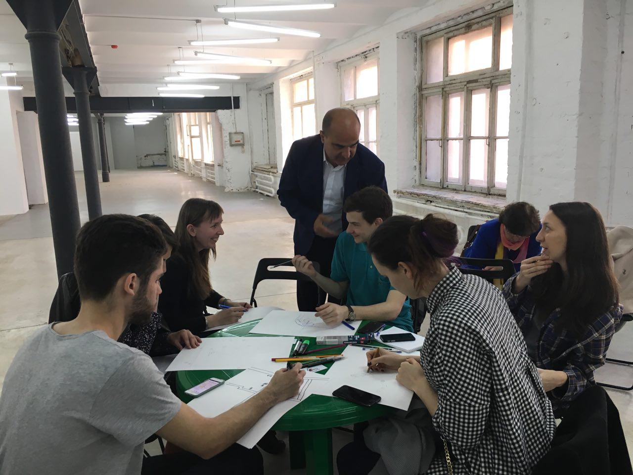
Vicente Guallart with workshop participants
The discussion on the need to transition to a polycentric city model has been especially pressing in the professional community in recent years. For example, a study entitled ‘Archaeology of Outskirts’ was prepared for the 2013 Moscow Urban Forum. A section of the paper concerning economic issues was supervised by Alexey Novikov, Dean of GSU, and dedicated to the polycentralization of Moscow.
An alternative to a polycentric city, or a next stage in its development, is a decentralized city, the best known examples of which are New York and Barcelona. In such a model, not only do ‘points of attraction’ beyond the downtown evolve, but a number of self-sufficient cities exist inside the big city. Each of the clusters has the same number of services, businesses and jobs as any other.

The idea of a decentralized city was described in Vicente Guallart’s paper ‘From Urban Planning to Urban Habitat’ (Plans and Projects for Barcelona 2011 – 2015). A cluster with a 500-metre radius is used as a standard cell for a decentralized city. Within these limits, the following types of services provided to residents should be equal to those in the other clusters: food, health, education, culture, sports, administration, civil functions, and jobs.
The city administration should maintain such independent clusters’ integrity with the other parts of the city. In Barcelona, one such project is a new scheme for public transportation and bicycle traffic. This new scheme allows people to commute from any point in Barcelona to any other point with just one transfer.
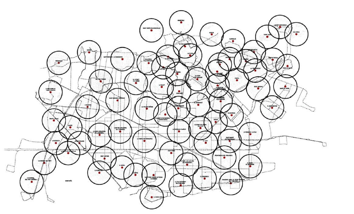
Decentralized city, Barcelona. Many self-sufficient cities within one city. Source: Plans and Projects for Barcelona 2011 – 2015.
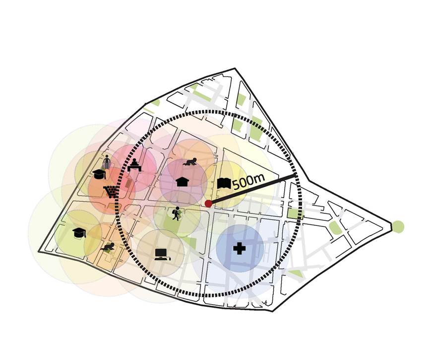
City district on a human scale. Source: Plans and Projects for Barcelona 2011 – 2015.
Result
As a result of the workshop, 30 plans illustrating the distribution of services and businesses in various parts of St. Petersburg were received in less than an hour. The following discussion on the map of decentralized St. Petersburg revealed more self-sufficient districts, as well as districts where certain services still need to be developed.
This exercise didn’t aim to thoroughly analyze the opportunities for St. Petersburg’s development as a polycentric or decentralized city; rather, it was important to demonstrate that even such simple exercises can provide fertile ground for consideration, help detect the city’s problem points, find alternative centres, and detect underdeveloped areas.

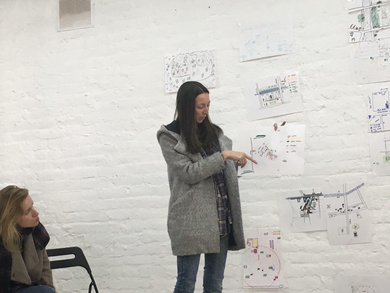
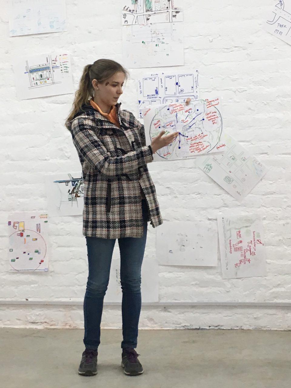

Workshop participants demonstrate their maps of decentralized St. Petersburg
Opinion

Arina Miksuk, workshop co-organizer, project manager at ARTS4CITY, graduate of the HSE Graduate School of Urbanism
A mental map is a live and relevant map of a city (an area). It is not a soulless map providing facts, but a revelation of things that are really present in people’s lives, locations important for them, and their movements. Such a map is illustrative and can help detect an area’s gaps and problems, its points of attraction, and the ‘spirit of the place’. This exercise is always useful when we want to understand what a specific place means for specific people. When we have a sufficient sample, we can conclude how a place is reflected in the minds of many people, and to draw representative conclusions on its space, intensity and functionality.
Such activity is useful when we study an area, since it is based on people’s memories, and usually the things that come to mind first are the most important ones, things that we use the most.
It’s hard to draw specific conclusions, since we’ve collected only about 20 maps, and each district of the city has been described only once. But the participants’ presentations demonstrate that most of the people living in the outskirts need more points of attraction, places of active interaction, and a good urban environment.
While an area may meet basic needs with shops, kindergartens, schools, clinics, available public transportation, parks, cinemas and shopping malls, there is still a clear shortage in its functional variety. This means there are no jobs close to the place of residence, as well as restaurants, bars, theatres, museums, and places of interest. Respondents who live downtown, on the contrary, have an active cultural and business environment, but they lack shops, parks, places to walk dogs and visit with children, and experience environmental problems. The received maps can lead us to conclude that St. Petersburg doesn’t have one clear centre, like, for example, Moscow. It has three centres – Vasilievsky Island, Petrograd District, and Nevsky Prospekt with Dvortsovaya Ploshad. There is a stub of a new centre that can be considered a new unique area in the city in terms of its functions and quality of urban environment and is comfortable for both living and work. This is the Primorsky District, where Gazprom is building its Lakhta Centre.
Maria Smirnova, Designer at Bezhko
This activity is a quick way to see the advantages and disadvantages in development downtown and on the outskirts, the connections between them or lack thereof. Unfortunately, the main attractions and cultural events are concentrated in the city centre.
The students came up with some ideas about how to revive their areas or districts. These ideas can be implemented and would allow residents to spend half of their time in the area without feeling detached from something bigger.

Maria Smirnova
The students came up with some ideas about how to revive their areas or districts thanks to this activity. Some ideas can really be implemented and would allow residents to spend half of their time in the area without feeling detached from something bigger. For example, co-working areas could become attraction points in residential areas, all the more so that many people work online today. And co-working areas attract other businesses, which eventually transform the urban environment.
Vicente Guallart
Vicente Guallart
Academic Supervisor of the Shukhov Lab (Laboratory for Experimental Urban Design)